Assessing Geotechnical and Coastal Engineering Performance of Coastal Resiliency Projects
Growing environmental threats to coastlines—including flooding, erosion, and rising seas—pose numerous challenges, among them protecting valuable coastal ecosystems by increasing their resilience. Planning for resilience in coastal areas takes more than just assessing vulnerability and risk. Successful designs of coastal restoration structures, like living shorelines and reefs, must consider both geotechnical and coastal engineering performance while undertaking proactive adaptations (and reactive measures) to achieve the greatest resilience and long-term performance.
To achieve resiliency along the coast, it is inadequate to rely solely on reactive responses.
Evaluating Project Sites with Geotechnical and Coastal Engineering Approaches
Various engineering approaches can be evaluated when developing structures to offset the effects of sea-level rise and other coastal hazards. Project teams must consider hydrodynamic impacts, such as waves, tides, storm surges, winds, ice loading, and in some cases, vessel forces in addition to the geotechnical performance of a coastal structure. Thorough geotechnical assessments should consider the bearing capacity of the soil to support coastal structures, the slope stability, and the ground settlement, in addition to the subsurface conditions and the physical, mechanical, and chemical properties that will influence a project.
Assessing Common Geotechnical Challenges and Their Solutions
Coastal modeling must consider a range of environmental factors that need to be addressed to overcome geotechnical challenges. The following are some of the common challenges facing coastal resiliency projects across the nation:
Challenge. Obtaining the subsurface data necessary to design resilient coastal structures can be very expensive, requiring larger crews, more time, and more planning than budgets allow.
Solution. A phased design approach or sequenced data evaluation can help focus data needs to avoid unnecessary data collection and provide a steady accumulation of information. Seasonal work windows should be factored into project schedules so work can be reasonably performed to obtain needed information.
Challenge. Environmental factors, such as deep offshore water depths, storms, and waves, and tides can make obtaining geotechnical information extremely difficult, necessitating large, specialized equipment for more stability.
Solution. Equipment such as jack-up barges, limited-access drill rigs, and underwater CPT can help teams deal with waves, deep water, and difficult access areas. Consulting with contractors familiar with the specific environment and using extremely specialized equipment can also be helpful.
Challenge. Soft offshore sediments cannot always be sampled with traditional equipment, and designing for them or predicting their behavior can be very difficult.
Solution. When dealing with soft materials and difficult design conditions, it is essential to be prepared to face soft sediments to avoid losing important data. It may be necessary to utilize equipment suitable for obtaining data in soft sediments and minimally disturbing test methods, such as push cores. When designing structures over soft sediments, consider evaluating a toe berm to enhance slope stability. Sequencing construction and using geofabrics may also allow the soil to gain strength and bear larger loads.
Understanding and measuring a community’s ability to withstand an event is often the first step to finding the right resiliency solution.
When working with limited data, project teams can sometimes leverage past evaluations to refine their analyses. Reviewing previous efforts to support habitat restoration and coastal resiliency can help us better understand the approaches taken and the challenges faced—and overcome—during the geotechnical and coastal engineering design process.
Along with these dynamic engineering approaches, it is important to understand the goals of the project and the project’s interaction with the environment. For example, if the project’s goal is marsh habitat elevation, does it need to consider estimated sea-level rise? If the project’s focus is on coastal protection, how severe are the consequences of storm surge? Can the project be adaptable to meet design needs over its design life? The answers to these questions will ultimately determine the design and success of the coastal restoration structure.
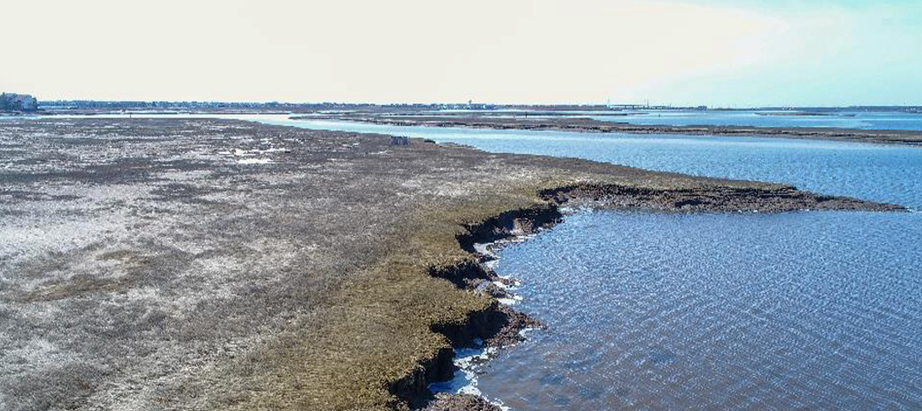
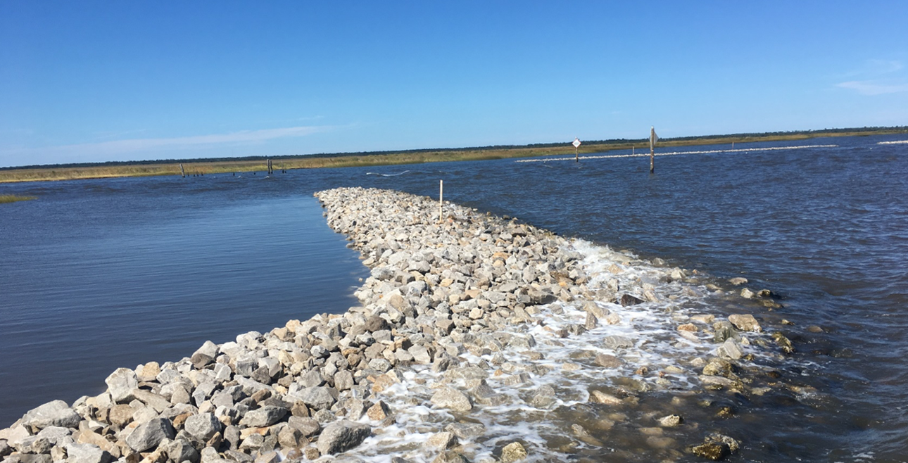
Living Shoreline to Protect the Shooting Island Wetlands
A project to restore Shooting Island, a significantly degraded coastal marsh in New Jersey, will create coastal resiliency, provide an environment for wildlife, and reduce storm impacts to the coast. Coastal evaluations—including wind and wave modeling, sea-level rise assessment, and berm design and stone sizing— were performed to ensure the living shoreline will preserve Shooting Island and protect its wetlands from future erosion.
Geotechnical evaluations of the coastal protection structures considered the bearing capacity of the sediment and long-term settlement to ensure design heights will be maintained. These geotechnical evaluations utilized lessons learned during the rebuild of an access road nearby, which provided important information on the performance of the subgrade under new loads. Construction involved controlled and sequenced material placement protect against bearing capacity failures.
The creation of living shorelines is an innovative technique for achieving coastal stabilization, protecting the shoreline while providing valuable habitat.
Increasing Resilience in the Great Lakes
The State of New York established the Resiliency and Economic Development Initiative (REDI) to increase the resilience of shoreline communities and bolster economic development in the Great Lakes region. One area addressed by the REDI program is Blind Sodus Bay. This half-mile-long barrier bar along the coast of Lake Ontario was severely compromised by major storms over the past 5 years, exposing the bay and the lake shorelines to erosion from wind-generated waves.
Various geotechnical challenges, including soft soils, variable subsurface conditions, and steep slopes, made assessments and predictions of slope stability difficult. Harsh weather from the lake and large waves made for a challenging coastal environment, so the design of the coastal resilient structure required numerous iterations. Our coastal design team also developed a detailed wind, wave, and current model to locate, size, and design offshore reefs and living shorelines. Despite the geotechnical engineering challenges, our geotechnical team and coastal design team were able to work together on a collaborative coastal resilient design that would effectively mimic natural features to reduce shoreline erosion, enhance habitat restoration, and protect valuable embayments.
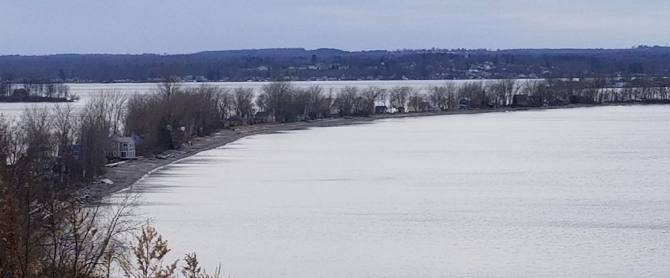
Shoreline erosion in the Great Lakes region has created risks to nearshore homes, businesses, roads, and parks.
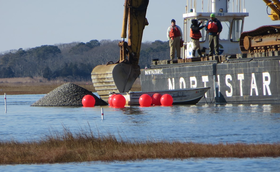
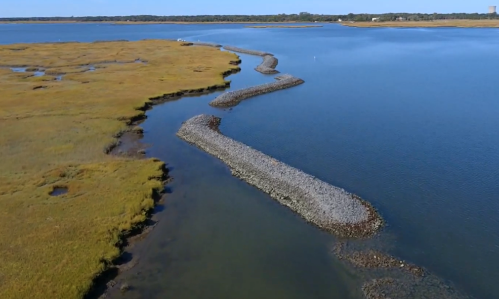
Overcoming Geotechnical Challenges to Make a Lasting Impact on Hancock County Marsh
In 2015, Hancock County marsh was the fastest eroding marsh in Mississippi, losing 7 acres of intertidal marsh per year. To preserve existing habitat, cultivate ecosystems, and protect against erosion, a restoration project consisting of 6 miles of living shoreline with a segmented rock breakwater, 46 acres of subtidal reef, and approximately 46 acres of the marsh was undertaken. This unique combination of structural and non-structural features was designed to reduce storm damage and enhance the restoration of aquatic habitat.
Our team performed detailed geotechnical, wind-wave, and current analyses to design and site the segmented breakwater, the subtidal reef, and the project’s marsh components. Hancock County marsh faced sea-level rise in addition to hurricanes and other storms, and these factors were taken into account when we designed natural features and the living shoreline to dampen wave energy and reduce shoreline erosion.
Anchor QEA provided engineering, design, permitting, and construction assistance services for a living shoreline project that involved protecting existing habitat while providing areas of secondary shellfish.
Multiple geotechnical obstacles—including a vast project site and subsurface variability—were evaluated when the settlement of the proposed breakwater design was assessed. This design was approached in multiple phases, with the performance of each phase of the design taken into consideration when planning for the construction of successive phases of the shoreline. We considered long-term maintenance and additional rock placement as ways to address any uncertainty about the settlement at the site.
Our team also had to grapple with variable settlement in different areas, which requires planning for ongoing maintenance to maintain elevations at design levels over the long term. Ultimately, this project’s living shoreline design not only reduced wave energy, but also re-established habitat along the coast, protecting the shoreline and providing aquatic sanctuary for decades to come.