How To Build Coastal Resilience and Implement Restoration Projects in the Carolinas
Coastal communities across the nation have seen a significant uptick in tidal flooding over the past few years and are increasingly vulnerable to the effects of coastal hazards. Low-lying regions such as the Carolinas are especially exposed to severe storms, flooding, and rapid shoreline change. With coastal erosion costing millions of dollars each year in lost land and damaged buildings, bridges, and other structures, increasing resilience is important for counties as they plan and budget for adapting to climate change.
The National Oceanic and Atmospheric Administration has noted the growing risk coastal communities face from sea level rise, coastal flooding and accelerated erosion.
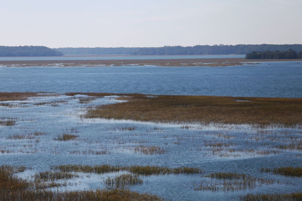
With one of the largest areas of wetland resources on the Atlantic Coast—including salt and freshwater marshes, swamp forests, bogs, and swamps—North Carolina is in the early stages of developing the North Carolina Flood Resiliency Blueprint. This will be an important planning tool for major watersheds that may be prone to flooding in the future. Understanding the risks to the coastline while also providing communities with tools to help reduce risk from future coastal hazards are crucial for adapting to climate change and achieving long-term resiliency.
Restoring Coastal Wetlands, One at a Time
A variety of environmental solutions and management approaches are available to protect coastal areas and ecosystems while enhancing habitats and making coasts more resilient. Actions such as wetland restoration and oyster reef construction can both have a positive effect in protecting the shoreline.
Thin layer placement is one technique to restore marshes and wetlands, commonly used for a variety of purposes such as sediment management, beneficial use of dredged material, and ecological enhancement. Thin layer placement is the purposeful application of thin layers of sediment in an environmentally acceptable manner to raise the marsh planform to a target elevation or thickness and thus promote its ecological value and resiliency benefits. Because thin layer placement uses a low-stress “raining” method to lay down material, marsh vegetation will naturally restore within two to three growing seasons—as long as the placement thickness is kept below one foot. The U.S. Army Engineer Research and Development Center is currently developing a national guidance document on thin layer placement which includes a discussion on best practices for planning, designing, constructing, and monitoring such projects.
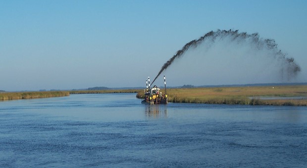
Thin Layer Placement being applied to restore wetlands in Maryland’s Chesapeake Bay (Source: U.S. Army Corps of Engineers, Baltimore District)
Tools and Assessments for Vulnerable Communities to Achieve Resilience Goals
While there is no single method that fits all coastal flood management problems, resilient solutions such as thin layer placement often must be developed collaboratively with stakeholders. For counties that want to obtain restoration or resiliency grants, it is critical to be able to show not only how a project will affect the nearshore environment and the surrounding habitats but also how it will improve the community in the long term.
Other tools are also available to aid counties in establishing frameworks to help their communities make decisions related to reducing flood risk and increasing resilience. For example, a new analytical tool created by the National Fish and Wildlife Foundation and the National Environmental Modeling and Analysis Center at the University of North Carolina at Asheville can identify coastal areas that have the greatest potential to boost community resilience and improve habitats for fish and wildlife. This tool will help conservation nonprofits, government agencies, and local communities identify areas where they can maximize returns on investments and achieve multiple resilience and conservation outcomes.
Building Coastal Resilience in the Carolinas with Oyster Reef Construction
Oyster reefs are another environmental solution available to boost resiliency and protect coastal areas and ecosystems. These reefs can provide ecological benefits by improving water quality, reducing coastal erosion and sheltering juvenile fish. They also benefit estuarine habitats by attenuating wave energy in order to reduce erosion. The North Carolina Division of Marine Fisheries, National Oceanic and Atmospheric Administration and the North Carolina Coastal Federation are actively promoting subtidal oyster reef restoration in Pamlico Sound. The recently constructed Swan Island project (part of the 50 Million Oyster Initiative) provided coastal resiliency and habitat benefits by reducing waves and tidal currents in the area, thereby enabling reestablishment of benthic habitat. The Coastal Federation continues to support such projects and are actively monitoring constructed projects.
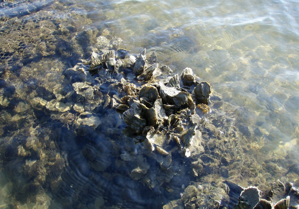
Oyster reefs must be designed with careful consideration of several key components, including ecological functions, hydrodynamic modeling, coastal process evaluation, and geotechnical engineering.
The design of coastal structures, such as oyster reefs, are evaluated for oscillatory forces due to waves and currents, which may be seasonal, wind-driven events, tropical, or wakes from passing vessels. It can be difficult to prioritize areas of an expansive coast where reef construction would be optimal, and due to changing conditions, legacy locations may no longer be the best place for new reefs. To evaluate optimal locations for oyster reefs and associated wave/current interaction patterns and nearshore circulation, a 3D hydrodynamic model is often useful. Anchor QEA’s proprietary 3D hydrodynamic model of Pamlico Sound can be used for future planning efforts to provide a more objective, holistic approach to designing and developing oyster reef restoration projects.
Example Salinity and Velocity predictions from Fine Resolution Modeling Grid for Pamlico Sound developed by Anchor QEA.
One of the reef options considered for Pamlico Sound called for placing a series of mounds of Class B limestone riprap, crushed concrete, or other materials. Another, easier to construct, option was to build a series of nearshore reefs that would break the waves and provide habitat diversity. Other site-specific solutions can be developed, often with the principles of “Engineering With Nature (EWN)™” and nature-based solutions in mind. Anchor QEA, in partnership with the Healthy Port Futures Consortium, has been advancing nature-based solutions at several locations around the Great Lakes and in the eastern United States to restore coastal habitats and cope with ongoing littoral sediment transport concerns.
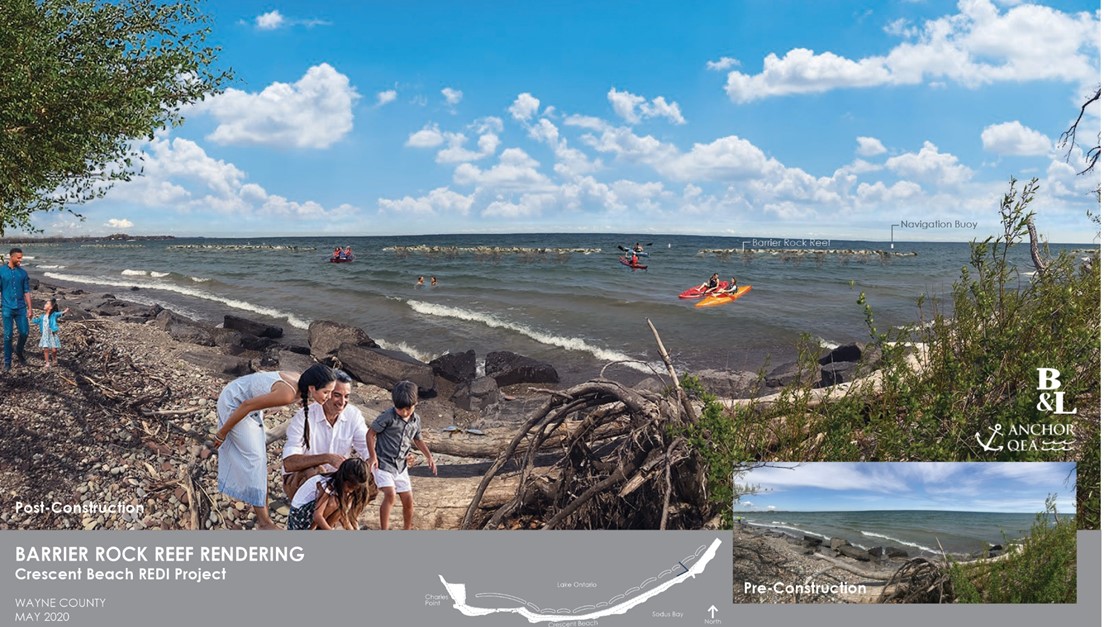
Rendition of a proposed nearshore reef and nature-based shoreline restoration design for Crescent Beach, Lake Ontario, a project partnership between Anchor QEA and Barton & Loguidice, D.P.C.
With any restoration or resiliency project—especially those integrating EWN™ principles—a reliable coastal modeling framework is necessary not only to evaluate how effectively the proposed measure(s) will reduce wave energy and storm surge, but also to infer habitat and recolonization benefits. Ultimately, with various resiliency tools and applications, communities will be better able to implement resiliency programs and identify where natural methods of shoreline stabilization will thrive along the Carolinas’ coasts.

Ram Mohan, P.E., Ph.D., F. ASCE.
Principal Coastal Engineer
rmohan@anchorqea.com |